Archive for the ‘Uncategorized’ Category

Call for Posts, AW #37: Sexy Geology

July 27, 2011

This month’s Accretionary Wedge asks the titillating question, “What is ‘Sexy?'”  Hint: we’re not talking Victoria’s Secret.

I mean geology that makes your heart race, your pupils dilate. Rocks and exposures that make you feel woozy and warm. Structures and concepts that make your skin alternately sweaty and covered with goosebumps. Places you’ve visited, read about, or seen photos of that make you feel weak-kneed, and induce a pit in your stomach.

Click over to read the full description of what this month’s topic is (and is not) meant to entail. If you have a post to submit, please leave a comment and link either here or at the original call for submissions, so I can find it when I go to assemble this edition.

Accretionary Wedge #36…Stuff Left Behind, With Regrets

July 27, 2011

(Note: this is a repost of Accretionary Wedge #36…Stuff Left Behind, With Regrets, originally posted at GeoSciBlog. To see original post and all the comments, click the link above.)

What have you left behind in the field? What have you lost or what do you regret not having collected, including photographs?  [Before going further, I would like to thank all of the participants.]

The first contributor, Evelyn Mervine recounts some fascinating field work in the Indian Ocean, then she goes on to relate what she regrets not bringing home – a baby goat or a baby camel from Oman. I wonder what U.S. Customs would have had to say about that? [I once used a large paper cup to catch a kangaroo rat (for a few minutes) in the Eagle Mts. of West Texas, but it wouldn’t have acclimated to a caged existence.]  If one lived on a farm, bringing home such “souvenirs” from the field might work, but not so sure in a two-bedroom apartment.  I don’t know whether goats and camels can be housebroken.  Here is her post in its entirety.

From Ann’s Musings on Geology, Ann muses on her extensive 35-mm photographic past and photos she didn’t get. She recounts such issues as not wanting to expose her camera to adverse conditions, e.g., dust or rain or not wanting to carry the extra weight. [Been there, done that on both counts.] She also described the familiar college-student issues, such as the expense of film purchases and development costs. As I did, she chose slides as they were cheaper. Another constant issue with 35-mm film photography, you had to wait to know if you got one or more decent shots.  Many times, once she found out that she didn’t get a good photo, it was in a situation where there were no do-overs, no chance to revisit the site.  [Another 35-mm hazard – forgetting to reel the film back into the cartridge before you open the back of the camera.  In 1982, I lost all of my Wisconsin glacial features slides when I did this.]  As I do, she now faces the dilemma over what to do about all of those slides and how to convert them.  Hopefully this can be resolved in a satisfactory way, with a scanner of some type.  [I have a scanner, but not the time.]

Dana Hunter also reminisces about the Photo Not Taken. Actually of the photos not taken when she lived in Arizona. The empty photo-box syndrome. I can attest that there is plenty of good geology to be photographed in all of Arizona, especially the northern half of the state…San Francisco Peaks, Page, Sunset Crater, Grand Canyon, Sedona, Jerome, Barringer Crater, Canyon de Chelly, Shiprock,…

Silver Fox at Looking for Detachment is the first to report on regretting leaving a geological/archeological item in the field.  From her account, after being literally dropped-off by helicopter at a field site: …”I found a large pink projectile point in the middle of the drainage I was walking down, a drainage that had obviously seen some flooding in the last 1 to 5 years. The point was possibly made of Ivanhoe “chert” (more precisely opalite or silicified tuff) from the Tosawihi Quarries of northern Nevada, a large series of rock quarries made by ancient to nearly present-day native Americans…”   In following accepted archeological protocols, she left the point, intending to mark the locality on a map for later collecting by a “trained professional”.  For whatever reason, the info didn’t get passed along and the point was probably washed further downslope with later weather events.  [I once got a polite lecture from a friend about collecting a silicified limestone “hand tool” from a roadside site, but I was able to drive him to the site and point to the exact location, so he could relate it to his archeologist girlfriend, so no damage done.]

The next contribution comes from Egypt!  Way cool.  Selim Abdelrhman reports on the strange rocks of Wadi Elbattekh in Egypt.  From his words: “OK, Wadi Elbattekh or وادي البطيخ my translation is “Watermelon Valley” it’s aWadi filled with strange rock shape and very soft in touch. i think the origin of this rocks is still a mystery.”…

From Casey at Giosciencecomes regrets of not having collected more samples (and taken more photos) of ripple-marked sandstones during at 1998 GSA Southeastern Section fieldtrip in WV, a fieldtrip that included the legendary sedimentary petrologist Bob Folk.  The ripple marks were in the Devonian Foreknobs Formation, part of the Catskill Delta.

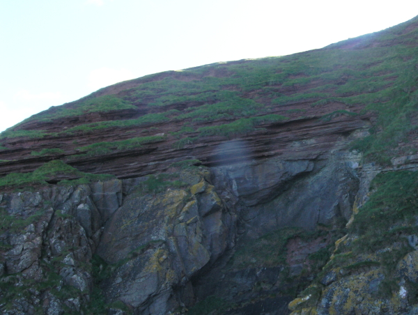
The proprietor ofGeologyMelange brings us his first geoblog post.  The subject of regret was a past visit to part of Marble Canyon in Death Valley.  Of most interest was an apparently un-mapped outcrop of deformed crinoid “hash”.  There were a sufficient number of photos taken, but no measurements were taken of the size or orientation of the outcrop and not enough samples were collected.  But of even more interest were the cobbles of white marble, the origins of which were not discovered.

A photo of Christopher with a fault-breccia in Marble Canyon, just above the canyon sediments.

Ron Schott admitted not collecting enough samples from certain sites, taking enough notes, or taking enough photos.  But his greatest regret was losing his first Estwing Rock Hammer, which he was given as part of his Colgate Univ. Field camp gear.  It served him well in field camp, but when he visited Giant Mountain in the Adirondacks, the spirits of the mountain became incensed at his collection of samples of the Roaring Brook intrusion breccia.  The spirits extracted their revenge by relieving him of his beloved hammer from its improvised rope belt.  [I know the feeling.  My Dad gave me a brand new Estwing Rock Hammer when I left home to go to UTEP for grad school.  Despite having the handle wrapped with day-glow orange tape, I managed to lose it in the Eagle Mts., about a year and a half later.]

Jessica Ball (aka Tuff Cookie) has a similar story of losing a “first piece of field equipment”, a little smaller, but still important.  Somewhere in the area of Sugar Hollow in the Virginia Blue Ridge Mountains, her first hand lens slipped off its lanyard.  From a separate adventure, she regrets not having kept her first pair of hiking boots, with partially-melted soles from an encounter with some of Kilauea’s fresh lava flows.  I am sure that those boots would have been good for some stories.

For my contributions, there are actually two different ones. In 1979, I had a summer job in the San Juan Basin of NW New Mexico, as part of a fossil recovery project, prior to the opening of an open-pit coal mine. Outside of our project area – on the road back to the dirt “highway”, there was a reddish-colored outcrop of “clinker” material, i.e., baked Cretaceous shale with plant fossils. The baking was probably courtesy of an ancient, underground coal-seam fire. After driving by this site to – and from – my “days off”, I decided to stop and have a look. I regret only picking up two specimens from this site, one (pictured) with an angiosperm leaf and a stem fragment and another with a piece of a stem. WHY DIDN’T I AT LEAST FILL A BUCKET FROM THIS SITE? I will never know.

The image is labeled for use in my classes.

The other under-collected site was the previous summer, when I was in the Eagle Mountains in West Texas. While surveying the area – as part of a planned thesis project, which was never finished, in favor of another a few years, later – amid the caldera breccias and ash flow tuffs, I found a chunk of siltstone, with some tiny impact craters. I regret not even doing a rough draft of the extent of this intra-caldera siltstone. It most likely was reworked, water-deposited ash, with roughly-defined bedding planes. The surface was marked by a few tiny impact craters, suggesting bombardment by explosion debris, while the upper surface was exposed, but soft and “plastic”. Looking at cross-sectional view, there was evidence of other small impacts by broken crystals/rock fragments. I often include this in lab instructions to remind students that it is possible to find sedimentary rocks inside of volcanoes. SO WHY DIDN’T I PICK UP MORE CHUNKS OF SILTSTONE?  [BTW, the place where I lost my Estwing rock hammer was a stop or two past the siltstone locality.  Hmm, is there a connection?]

[Update: A couple more attendees to the party!]

Water and Rocks…At The Same Time reports on the discovery of a chevron fold in an outcrop of the Dolgeville Fault on a tributary of the Mohawk River, near Dolgeville, NY.  The photo at left shows a portion of the fold.  Several members of the field trip party picked up folded portions of (presumed siltstone), but Roy didn’t want to add anymore clutter to the crowded van (be there, done that on a crowded field trip bus, it is hard to keep samples organized and under control).  This was his 2nd chevron fold, the first he donated to his alma mater, SUNY Oneonta.  Roy, you have my permission to collect the next chevron fold for yourself.

Dr. Ian at Hypo-center reports on some important items ALMOST LOST during field work in Lukmanier Pass region of Ticino, Switzerland years ago.  After picking up a fair-sized sample of gneiss: …”I was crossing a boulder field and noticed an interesting looking exposure up a steep face to my right. I put my notebook down on a rock, placed my map case on top of it, and my gneiss sample on that to stop it blowing away. I then headed up to the steep outcrop with my compass-clinometer thinking I could easily remember a couple of readings and rock details and return to record the information in my notebook.”…  After climbing upwards to check out more interesting metamorphics and record several more structural readings, he turned around to re-orient himself and return to collect his sample, notebook, and map case, when he realized – “Just damn! – all them boulders look the same!” (or something like that).  More from Ian: …”After an hour a mild panic started to set in. Had I just lost three weeks work down to my own stupidity? Since I knew that they had to be in the boulder field somewhere,…”  He searched for two more hours.  At the point of almost giving up hope, he decided to do two more passes through the boulder field, then he realized that the items of interest were a mere 10 meters away from him.  But a sad postcript follows this reunification of geologist and field equipment…  …”After my degree, I went to Cardiff to do a Ph.D. and I told the metamorphic petrology lecturer about the wonderful metamorphic rocks at Lukmanierpass, including hornblende garbenschiefer and kyanite schists…I showed him the box of my rock samples that I had collected there. He asked if he could hang on to them for a while and I agreed. With the passing of my Ph.D. I completely forgot that I had lent him the rock samples. I moved on to Keele, and he moved on from Cardiff.”  So the location of the box of rocks is a mystery.

Well, us Geologists and our stories of “the ones that got away”.  Maybe some younger folks will learn something from our travails, lost samples, unphotographed localities, lost equipment, and regrets.

Call for Posts, AW #36

July 9, 2011

“What do you regret leaving behind at a geological locality?” In other words, what samples, specimens, or even photographs do you regret “not getting enough of”?

Read the full description at Geosciblog- Science; deadline is ~July 16.

Accretionary Wedge #34: Encore

June 26, 2011

(See orignal post and comments at En Tequila Es Verdad)

So I post the Accretionary Wedge #34, pack up the tents and roll the carnival out of town, and what happens?  People who should’ve been part of the show turn up.  Seems we’ll have to roll back in, then, because these acts shouldn’t be missed!

Image Credit

Due to Twitter not notifying me of a critical message, Anne Jefferson’s brilliant “Bacteria in the sky, making it rain, snow, and hail” got left at the side of the road. And that’s bad, because it’s headspinningly weird! Biology contributes to hydrology which is part of geology contributes to biology and around and around we go!  The remarkable interconnectedness of all these things – life, water and rocks – can make dizzy.  Kinda feeling like I’ve been standing in the center of a really fast merry-go-round now…

Speaking of standing in the center of things that make you feel funny, Helena’s Weird AND Scenic scenery at Craters of the Moon will leave your head spinning happily.  What’s weirder than a landscape that looks like “black vomit” and is so heavy that it’s sunk a 100km region right down?  Rafting volcanoes, dragon skin, a maclargehuge rift – that’s weird and no mistake!

While we’re on the subject of craters….  My Intrepid Companion likes to pretend he’s got nothing to say about geology, but he does.  And he seems to think a maclargehuge hole in the ground caused by a meteor isn’t weird, but when you think about how rare it is to find one this perfectly preserved on Earth, what with all our various agents of erosion, it totally is.  So, go feast your eyes on what happens when outer space geology smacks in to Earth geology.

Garry Hayes at Geotripper rather made my jaw drop with this one: Weird Geology: Accretionary Wedge #34…Our Human Nightmares.  Because I hadn’t put geology and pareidolia together before, but he did, and it’s fascinating.  Beautiful.  And just a little deliciously scary.

So you see, my darlings, why this carnival had to roll back in to town.  The world is far more weird (and wonderful) than we’d revealed in our original installment.  And over this next year, keep your eyes open for odd, outrageous, and ooo-inducing geology, because we’ve not yet exhausted this topic, and you could run away and join the weird geology carnival next summer.

Accretionary Wedge #34: Weird Geology

June 26, 2011

(See original post and comments at En Tequila Es Verdad)

It seems to me that there would be no such science as geology if dear old planet Earth wasn’t really damned weird.
Image Credit: Chris Rowan

People had been running into seashells on mountaintops for years.  Seashells.  On mountaintops.  “That’s weird,” they said, and eventually, some clever types not content with “Funny old world, innit?” and “God must’ve done it” arguments said, “That’s really weird.  How’d they get up there?  How, in fact, did mountains get there?”  And then you had Hutton sailing people around to Siccar Point and pointing out the rather dramatic angular unconformity there.  Now, that was weird.  So weird he took twenty-five years and a very verbose book to explain it.

Now, of course, we don’t think it’s all that weird.  But that’s only because it’s familiar.  It’s like your Great Aunt Vanessa, whose personal quirks like dressing every square inch of exposed furniture surface in doilies and pontificating on the personalities of her plants strikes first-time visitors as mightily strange, but after you’ve got used to her and had the origins of those oddities explained away, just seems charmingly eccentric.

I mean, the very idea that these big ol’ solid continents go rafting round the world was so laughably ridiculous on its face that nearly everybody laughed at poor old Alfie Wegener when he floated the idea.  Sure, everybody’d looked at a map of the world at some point and went, “Hmm, Africa and South America are a perfect fit.  Well, that’s weird,” but not as weird as Wegener’s idea – until the evidence piled up, and everything fell into place, and the mountains made sense, and now everybody who knows anything about geology doesn’t think plate tectonics is all that weird at all.  But it is.  Really, really weird.  Just because something makes perfect sense and can be proven scientifically doesn’t mean it’s not strange.

It’s hard to remember how weird all this stuff really is.  Which is why I invited all you all to hop in the wayback machine or scurry out to the field in search of bizarre, befuddling, or simply baffling bits of geology.  What follows is a carnival sideshow of Weird Geology.  Step right this way, ladies and gentlemen, and feast your eyes on mind-boggling minerals, eccentric erratics, and a veritable smorgasbord of delightfully strange stones!

Image Credit: NIH

Roll up and see the famous Siamese Twins, Evelyn of Georneys and Michael of Through the Sandglass, conjoined at the posts Geology Word of the Week: Y is for Yardang and Yardangs: an Accretionary Wedge Weirdness Cross-post!  Feel the stare of the yardang!  Marvel at its perfect form and conformation!

Step right this way, ladies and gentlemen!  Hear Metageologist at Earth Science Erratics announce, “Chalk is weird.”  Surely not chalk, you say!  But surely yes!  This dull, dry, bland-tasting (admit it, you had a nibble, perfectly normal for a geologist even though you weren’t technically a geologist at that age) and indeed chalky rock is indubitably weird, and, dare we say, even strange.  See chalk as you’ve never seen it before!

And speaking of seeing, don’t believe your eyes!  Geology is a master of illusion.  Venture into Magma Cum Laude’s tempting tent, and Jessica shall show you illusions that will leave your brain befuddled and your senses insensible!  It’s all here in Weird Geology: Accretionary Wedge #34, wherein it is proved that seeing should not always be believing.

Image Credit: kh1234567890

Weird Geology?  Holy Haleakala, what’s weirder than molten rock? Let Matt at Research at a Snail’s Pace show you there’s nothing ordinary about rocks melting deep in the earth!

And then, ladies and gentlemen, come this way and walk on land – moving land, that is!  That’s right, Rachael at 4.5 Billion Years of Wonder has a Slow Motion Landslide that must be trod upon to be believed!  It will give a whole new meaning to “the earth moved.”  Guaranteed!

But that’s not all!  No, simple moving earth is not all landslides have to offer!  Let David at History of Geology show you The landslide of Köfels: Geology between Pseudoscience and Pseudotachylite, where you will find pumice created by the friction of a landslide!  That’s truly weird!  Weirder, even, than The toad in the hole

Watch your step, folks, watch your step!  That may be Quicksand you’re headed for!  At Ron Schott’s Geology Home Companion Blog, it is proved “that not all terra is firma,” a lesson you won’t soon forget!

Image Credit: The Church of Man-Love

Hoodoo?  Voodoo?  Erosiondoo!  Phillip at Geology Blues knows that Goblin Valley is Weird!  Take an eerie journey through the hoodoos, at night, on Halloween – the only way to see your truly weird geology!

Oh, but ladies and gentlemen, Malcom at Pawn of the Pumice Castle has landforms that are not only weird, but unsolvedAccretionary Wedge #34: That is Weird will introduce you to the great and terrible mystery of Mima Mounds.  Prepare to be amazed!

And, speaking of mounds, go Geocaching and discover Quellschwemmkegelmounds created by springs.  No mystery how these formed, but plenty weird, as Ole well knows!

Image Credit: Visboo

Ladies and gentlemen, you’ve seen breccia, but never like this!  You will marvel, you will ponder, Silver Fox of Looking for Detachment will prompt Some Thoughts on Weirdness, and A Picture (or Two) (or Three) – and what magnificent pictures they are!  How big can breccia be?  Come this way and find out!

Rocks can be magical, and what could be more magical than a crystal-filled rock appearing where no rock has ever been before?  Special to AW-34 Weird Geology, a blast from the past, Ann at Ann’s Musing on Geology and Other Things has the story of a stone rafted on ice, buried, and brought to the surface by frost. Marvelous!

Continue your tour of  Accretionary Wedge 34: Weird geology at Hypo-theses, where Doctor Ian will show you rocks that will make you gasp, yes, gasp in shock and delight!

And you know that Accretionary Wedge #34 – Weird Geology would not be complete without a very weird wave-cut bench, which On-The-Rocks at Geosciblog provides for your entertainment and edification.

Now see, right here at ETEV, captured in stone, frozen forever, phenomena that will make you wonder about Permanent Impermanence: or, How the Fuck Did That Fossilize?

And speaking of fossils, ladies and gentlemen, prepare to be amazed, astonished, and astounded at fossil rocks.  Step Outside the Interzone, where Lockwood hosts Weird Geology: Name That Rock Type!  What’s in a name?  Much more than you realize!

Ladies and gentlemen, the carnival is over, but the Weird Geology is still out there, awaiting discovery.  Take up your rock hammers, your beer, and your hand lens, don your boots, and go, intrepid explorers, to reveal the weird and the wonderful, the bizarre and the beautiful, the anomalous and the alluring bones of this good planet Earth.

Image Credit: IGN

DeskCrops, AW #28 Is Up

November 1, 2010

Take a look over at Research at a Snail’s Pace. The spooky Halloween edition with ghostly “tricked” entries is very clever. Nice Job, Matt!

Quick Reminder

October 27, 2010

The deadline for posts for AW #28, Deskcrops,  is Friday… only two days.  For a description, follow the link to Research at Snail’s Pace, and leave a note in the comments with a link to your (possibly spooky) domesticated rock.

AW #27 Is Up, AW #28 Call for Posts Issued

October 1, 2010

Wedge 27, “Important Geological Experiences,” is up at Outside the Interzone.

Also, though I forgot to note the AW #28 Call for Posts in as prompt a manner as I should have, there’s still plenty of time.  Matt at Research at a Snail’s Pace has kindly offered to host a wedge on the theme of deskcrops.

October’s theme is going to be “Desk-crops.” This can be any rock or other geological* specimen that you have lying around your office/desk/lab that has a story to tell. The spookier the better. Photos and/or illustrations are very important (although not absolutely required). This is taken directly from Ron Schott’sdeskrcop series” of his rocks and such – great examples of what I had in mind with the theme (but not the only way to skin this horse).

The deadline is Friday, October 29… so find your spookiest paperweights in time for Halloween.

Call for Posts, AW 27: Important Geological Experiences

September 4, 2010

I’ll go ahead and pick up the ball for the next Accretionary Wedge, and after thinking about it for a bit, the topic I settled on is “What is the most important geological experience you’ve had?”  The key word there is “important,” and the real task is going to be figuring out what that means for you.  It may (or may not) be something that led you to the discipline (Note that August 2009’s AW was “Inspiration,” what inspired us to get into geology, and this isn’t really intended to be a repeat of that, though for some, it might be.), or a class, or a work experience, or a field experience.  It might have been a puzzle or problem solved, or job landed, a degree completed.  Perhaps it was something else entirely.  It could have been an awful, disastrous experience from which you learned an important lesson. Maybe it’s still in your future- something you’re looking forward to.  Additionally, explain why it was important.  Was it something you’d recommend to others?

I’d like to get this up by the end of the month, which I think falls on a Thursday.  So let’s aim at getting submissions by Monday, Sept. 27- though as usual, late submissions will likely get picked up and rolled in at some point.  Have fun, and I hope to hear from you.  Leave links to posts either here or at my home blog, Outside the Interzone, where this will soon be cross-posted.

And of course, if you have an idea for a wedge and/or would like to host, October and later are open for volunteers!

Accretionary Wedge #25: An Illustrated Glossary of Cool Geological Things

July 31, 2010

Accretionary Wedge #25: An Illustrated Glossary of Cool Geological Things

Category: geologyphotos
Posted on: June 2, 2010 7:15 AM, by Chris Rowan

A post by Chris RowanA post by Anne Jefferson

Welcome to the latest edition of the Accretionary Wedge geoblogging carnival. We’ve been delighted by the response to our call for your favourite geological imagery, and the number of nominations we’ve received has been matched by their diversity – images have ranged from the microscopic to continental scales, from the depths of geological time to the present day, from the igneous to the sedimentary. The only way we could think of to do this smorgasboard of earth science justice was in the form of a visual dictionary, matching the images you’ve provided to the feature or process that they exemplify. Clicking on each image will allow you to see it in all its full-resolution glory at the original post, which in many cases also provides some more background on the geological feature or process depicted. Fun, pretty and at least a little bit educational – we hope you’ll have as much fun looking through our little glossary as we had putting it together.

A

Arch, natural – Formed by differential erosion at the base of a narrow ridge.

Photo: Arch, Arches National Park from Geotripper

Geotripper.jpg

B

Beach – deposit of unconsolidated sediment (sand, gravel, or shell fragments) at the land-water interface. One of many coastal zone morphologies.

Photo: Unknown beach with channel deposits. From Michael Welland.

Sandglass.jpg

GeoSciBlog breccia.jpg
Breccia – coarse sedimentary or volcanic rock with angular clasts

Photo: Pyroclastic breccia, Eagle Mtns, west Texas. From geosciblog.

Butte – prominent, isolated hill with steep sides and flat top. Smaller than a mesa.

Photo: Monument Valley by Dino Jim.

Dino Jim Mon Valley.jpg

C

Canyon (or gorge) – a deep, steep-sided valley, often formed by a river incising into a plateau or mountain range.

Photo: Canyonlands National Park from Geology Happens

Geology Happens.jpg

ebb tidal delta.jpg
Coastal zone – region where interaction of terrestrial and marine processes occurs. Morphology can take the form of a beach, barrier island, delta, cliff, or wave-cut platform.

Photo: Ebb-tidal delta – eastern Brazil. From Geologia Marinha e Costeira.

Conglomerate – coarse sedimentary rock with rounded clasts.

Photo: Ogallala/Arikaree formation near the Pawnee Buttes in north eastern Colorado (conglomerate butte landscape) from Russ Dale

Dale Cong.jpg

D

Debris flow – type of mass wasting where large clasts are carried in a mud-water mixture.

Photo: Debris flows, Pacific NW. From Anne Jefferson

Debris flow.jpg

PoolsRiffles.jpg
Dessication cracks – fractures formed by the shrinkage of clay, silt, or mud as it dries out from subaerial exposure.

Photo: Riviere de Terre – natural ‘artwork’ featuring dried, cracked clay. From Pools and Riffles.

Diagenesis – post-depositional alteration of sediments at low temperatures and pressures, often leading to the growth of new minerals in response to changing geochemical conditions.

Photo: pendant calcite crystals precipitated within meteoric aquifers during late Ordovician sea-level fall, Appalachians. From Suvrat.

Suvrat.jpg

Taconic.jpg
Differential weathering – divergence in the degree of weathering and erosion of different lithologies exposed to the same environment. Differential weathering is a factor in the formation of arches, buttes, and mesas, as well as steep slopes where some layers form vertical cliffs and other rock layers have subvertical exposures.

Picture: Letchworth State Park in Castille, NY, painted by Levi Wells. From John van Hoesen.

E

Exposure – the amount of geology that is exposed on the surface, and not hidden by pesky vegetation, soils, etc.

Photo: Cerro Divisadero, Patagonia, from Brian Romans

BrianR Patagonia.jpg

Olelog KT.jpgGeology Blues KT.jpg
Extinction event – abrupt disappearance of species, often as a result of extreme environmental changes, which can also result in a prominent lithological boundary. Significant (mass) extinction events include:

K/T (or K/Pg) boundary, 65 million years ago

Photos: (top) KT boundary at Stevns Klint in Denmark. From olelog.
(bottom) KT boundary, Makoshika State Park, Montana. From Geology Blues

Permo-Triassic boundary, 250 million years ago.

Photo: Permo-Triassic transition, Dolomites, N Italy. From Nologic.

Nologic.jpg

F

Folding – deformation of formerly horizontal layers of rock, usually due to compression.

Photo: Kings Canyon National Park. From Helena Heilotrope

Folding.jpg
Failed Rift Lamurde.jpg
_, plunging – non-horizontal fold axes, due to later deformation events.

Photo: Lamurde Anticline, from Failed Rift.

_, ptygmatic – occurs in sequences with high viscosity contrasts between layers.

Photo: ptygmatic folding in metagraywacke, from Callan Bentley.

Callan.jpg
Overturn.jpg
_, overturned – where high deformation leads to inversion of stratigraphy in fold limbs.

Photo: overturned syncline at Dog Canyon, Big Bend National Park. From Antonio

G

Gooseneck – the pinched bit of land in an extremely bowed stream meander.

Photo: Goosenecks, Utah. From Failed Rift.

Failed Rift Goosenecks.jpg

GeoFroth GCanyon Rain.jpg
Gullywasher – an intense rainstorm that activates ephemeral channels.

Photo: the most epic rainstorm of Kyle House’s life.

H

Hematite – iron oxide (Fe2O3), a common product of weathering and other low temperature alteration.

Photo: Hematite sheets, Red River Gorge, Kentucky. From Stubotics

stubonics.jpg

J

Jointing – rock fractures with no displacement across the fracture. Can be the result of regional stresses or cooling of volcanic rock.

Photo: Long’s Peak, from Pascal

Pascal Longs Peak.jpg

K

Kyanite – an aluminum-rich silica mineral (Al2SiO5), commonly deep blue in color, that generally forms during high pressure metamorphism.

Photo: Metamorphic kyanite, Scotland. From Life-Long Scholar

LLScholar Kyanite.jpg

L

Landslide dam – formed when a landslide blocks a river valley, these natural dams impound water upstream. Such dams can create hazards if the upstream impounded water floods property or if they suddenly overtop or breach releasing a flood wave downstream.

Photo: Attabad landslide, Hunza, N. Pakistan from Dave’s Landslide Blog

Landslide dam.jpg

Erte_Ale_1.jpg
Lava Lake – body of mostly molten lava contained within a depression over a volcanic vent.

Photo: Erta Ale, Afar, Ethiopia from Chris Rowan

M

Mesa – tableland with steep sides and flat top of uplifted, erosion-resistant rock. A mesa is generally larger than a butte.

Photo: North Caineville Mesa, just east of Capitol Reef National Park in southern Utah. From Jim Repka.

Repka Mesa.jpg

Lockwood.jpg
Mountain – the natural habitat of the geologist.

Photo: Ansel Adams, Winter Sunrise, Sierra Nevada. From Lockwood.

O

Ooids – round, concentrically layered sedimentary grains, usually of calcium carbonate.

Photo: Photomicrograph of ooids in a Jurassic carbonate, from Lost Geologist

LostGeo.jpg

LfDetach Gold.jpg
Ore – rocks containing high concentrations of economically useful minerals.

Photo: Gold with naumannite (Ag2Se), Northern Nevada. From Silver Fox.

P

Pioneer Species – the first organisms to colonise bare land, either newly created or swept clean by fire or flood.

Photo: First colonisation of lava flow by plant from Magma Cum Laude.

Magma Cum Laude.jpg.

mantle-zoom.jpg
Power Law Creep – a type of deformation where small increases in applied stress leads to greatly increased strain rates. Thought to control deformation in the mantle explaining how you can get extremely rapid mantle flow around subducting slabs.

Picture: model of mantle flow around subducting Alaskan slab, from Discovery News.

Precipice – often encountered by single minded geologists in search of the perfect outcrop.

Photo: from Kyle House.

GeoForth Snake Cliff.jpg

S

Seismic Reflection Survey – controlled release of sound waves to examine the subsurface structure of the Earth. Modern computer processing provides extremely high spatial resolution.

Photo: Buried paleo-channels in Gulf of Mexico. From Hindered Settling.

HindSett Sesimic1.jpg

seismogram.jpg
Seismogram – a visual record of ground motions due to an earthquake.

Photo: Seismograph for Mb 6.0 earthquake beneath the Kermadec Islands on Sept 21, 1981, recorded at Adelaide, Australia. From Hypocentre.

T

Tilting – regional deviation of beds away from the horizontal, usually in response to regional tectonic uplift.

Photo: Tilted sandstones, Fountain Valley, Roxborough State Park near Denver, Colorado. From Russ Dale

Dale sst.jpg

Geoberg.jpg
Twinning – where a crystal is subdivided into regions with different lattice alignments.

Photo: twinned selenite (sparry gypsum), from Lutz.

V

Volcano – an opening in the Earth’s surface through which lava, ash, or gases are erupted. Volcanoes chiefly occur in regions where rifting, subduction, or hot spots have triggered melting of the mantle.

Photo: Mt St Helens – volcano above a subduction zone. From Short Geologist.

Short Geologist Mt St Helens.jpg
Eyjafjallajokul.jpg